Best motorcycle routes in Laos: complete guide 2026
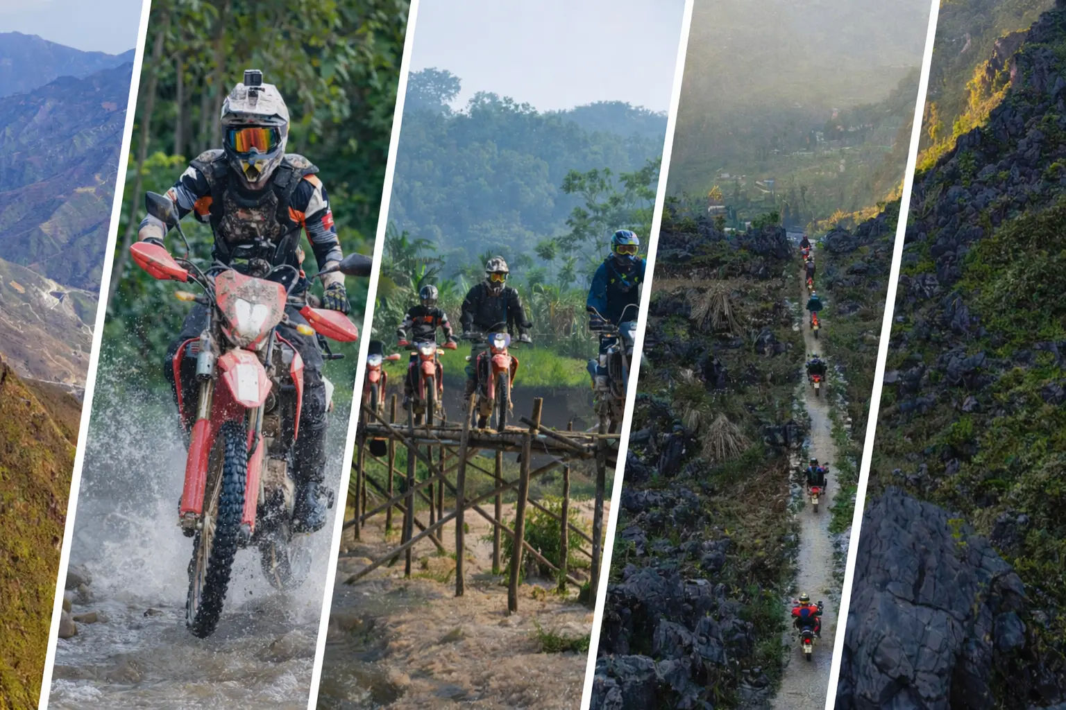
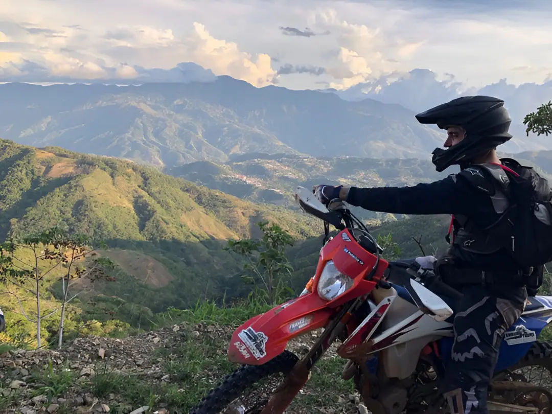
Laos has fewer riders per kilometer than any country in mainland Southeast Asia. Route 13, the backbone highway from Vientiane to Luang Prabang, carries a fraction of the traffic you find on Highway 1 in Vietnam. Dirt roads in the north can go hours without a single vehicle. That low traffic density, combined with mountains that reach 2,820 meters at Phu Bia and a river system that cuts dramatic valleys through limestone, is why serious motorcycle travelers keep coming back.
This guide covers 13 routes across all four regions, rated by difficulty, with specific road conditions, distances, and seasonal notes. It also covers things to do in Laos on a motorcycle beyond just riding, because the stops matter as much as the road.
- Check out Vietnam Laos motorbike tours
Difficulty ratings used in this guide
- Easy: Paved road, under 200 km per day, minimal elevation change. Suitable for beginners on any bike.
- Moderate: Mix of paved and gravel, some passes, 150 to 250 km per day. Requires basic off-road confidence.
- Challenging: Significant dirt sections, steep passes, limited fuel and services. Experienced riders.
- Expert: Technical terrain, possible river crossings, very remote. Requires full self-sufficiency.
When to ride: month-by-month breakdown
Laos has two seasons. The dry season runs November to April. The wet season runs June to October, with May as a transition month.
November to February is the best window for northern routes. Temperatures in Phongsali drop to 5°C at night. Mountain passes above 1,400 meters require a warm layer at any hour.
November to April covers central and southern routes. The Bolaven Plateau sits at 1,000 to 1,400 meters and stays cool even in April, when the lowlands hit 38°C.
June to October makes most dirt roads in the north dangerous or impassable. Paved routes like Vientiane to Vang Vieng and the Mekong corridor remain rideable but wet.
Motorbike routes in Laos: northern region
Northern Laos is where the country earns its reputation. The mountains between Oudomxai and Phongsali, and the valleys of the Nam Ou River, are unlike anything else in Southeast Asia.
Route 1: The Golden Triangle loop (Luang Namtha base)
Distance: 400 to 500 km | Duration: 3 to 5 days | Difficulty: Moderate to Challenging
Route: Luang Namtha → Muang Sing → Xieng Kok → Huay Xai → Pak Beng → Luang Namtha
This loop runs along the northern edge of Laos where the country meets Myanmar and China. Muang Sing sits at around 700 meters and has a large Akha population. The market in the early morning, before 7 am, has traders from across the border in traditional clothing.
From Muang Sing to Xieng Kok, the road deteriorates into gravel and packed dirt. This section takes 3 to 5 hours for roughly 60 km. The payoff is the Mekong at Xieng Kok, a small river village with boat connections to Huay Xai.
Huay Xai is the border town opposite Chiang Khong in Thailand. From there, Route 3 south to Pak Beng follows the upper Mekong valley. The road is sealed but narrow, with sharp drops on the river side and no guardrails for long stretches.
Road conditions: Paved from Luang Namtha to Muang Sing (50 km, good condition). Dirt and gravel from Muang Sing to Xieng Kok. Sealed from Huay Xai south.
Fuel: Fill in Luang Namtha, Muang Sing, Huay Xai, and Pak Beng. Do not skip Muang Sing before the dirt section.
Nam Ha National Protected Area covers 222,400 hectares north of Luang Namtha and runs alongside much of the early route. It holds wild elephants, gaurs, and clouded leopards, though spotting any requires a guided jungle stay rather than roadside luck.

Route 2: Phongsali loop (mountain pass adventures in northern Laos)
Distance: 300 to 400 km | Duration: 3 to 4 days | Difficulty: Challenging
Route: Oudomxai → Phongsali → Hat Sa → Muang Khua → Nong Khiaw → Oudomxai
Phongsali is Laos’s highest town, sitting at 1,400 meters. It is also one of the least visited provincial capitals in the country. The population is majority Phu Noi ethnic group, with a visible Chinese influence from the border 30 km north.
The tea plantations around Phongsali grow varieties that are 400 years old. Local guesthouses can arrange guided walks through the oldest stands. The tea here is sold primarily to Chinese buyers and rarely reaches international export markets.
The road from Oudomxai to Phongsali (Route 2 and Route 4) is 183 km and climbs consistently from 600 meters to 1,400 meters. Surface quality is variable, with long sealed sections interrupted by gravel patches and occasional landslide debris from the wet season.
From Phongsali, the descent to Hat Sa on the Nam Ou River is 30 km of switchbacks on a dirt road. Hat Sa is a boat landing; from here you can take the river south to Muang Khua, or continue by road. The river option takes 3 to 4 hours and is worth it for the scenery.
From Muang Khua south to Nong Khiaw on Route 1, the road improves. This section follows the Nam Pak River valley and has good pavement for most of the 156 km.
Mountain passes on this route: The climb from Oudomxai to Phongsali crosses two significant passes above 1,200 meters. The descent from Phongsali to Hat Sa is the most technically demanding section: loose gravel on the upper portion, compacted dirt lower down, steep gradient throughout, no barriers.
Route 3: Luang Prabang to Nong Khiaw
Distance: 140 km one way | Duration: 1 to 2 days | Difficulty: Easy to Moderate
Route: Luang Prabang → Nong Khiaw via Route 13 north and Route 1 east
This is the entry-level route for northern Laos. The road is sealed throughout, passes through the Nam Et-Phou Louey National Protected Area buffer zone, and ends in Nong Khiaw, a small town on the Nam Ou River surrounded by 600-meter limestone karst walls.
Nong Khiaw has two viewpoints reachable on foot. Pha Tok viewpoint is a 30-minute walk and gives a direct sightline down the river valley. Pha Daeng takes 2 hours and puts you on top of the ridge above town.
From Nong Khiaw, a rough dirt road continues 30 km northeast to Muang Ngoi Neua, a village without road vehicle access that most visitors reach by boat. Experienced riders can attempt the dirt road; it requires a small trail bike and takes 2 to 3 hours each way.
Route 4: Plain of Jars circuit
Distance: 200 to 300 km | Duration: 2 to 3 days | Difficulty: Moderate
Route: Phonsavan → Jar Site 1 (Thong Hai Hin) → Sites 2 and 3 → Muang Kham → Phonsavan
Phonsavan sits at 1,150 meters on the Xiangkhouang Plateau. The Plain of Jars archaeological sites are within 30 km of town. Site 1 (Thong Hai Hin) has 334 jars and is the largest and most accessible. Sites 2 and 3 require a 3 km walk on maintained trails.
The jars date to the Iron Age, between 500 BCE and 500 CE. Their function is disputed. One theory links them to burial practices; another connects them to fermentation of rice wine for passing trade caravans. No written records from the period survive.
Xiangkhouang Province was the most heavily bombed area in Laos during the Second Indochina War. Stay on marked paths at all jar sites. UXO contamination in surrounding fields remains high.
Hot springs at Bor Nam Ron, 45 km east of Phonsavan near Muang Kham, reach 60°C at the source. There are basic pools for bathing. The road there is sealed.
Motorbike routes in Laos: central region
Route 5: The Thakhek Loop (Kong Lor version)
Distance: 450 km | Duration: 3 to 4 days | Difficulty: Moderate
Route: Thakhek → Kong Lor → Lak Sao → Thakhek (Route 12 west and Route 8 south)
Kong Lor Cave is 7.5 km long. A flat-bottomed boat with a longtail motor takes you through from one end to the other, navigating the Nam Hin Boun River in the dark. The cave ceiling reaches 100 meters in the central chamber. The round trip by boat takes 2 to 3 hours.
The loop leaves Thakhek west on Route 12, crosses the karst uplands of Khammouane Province, and arrives at Kong Lor village after 165 km. The return leg goes north to Lak Sao near the Vietnamese border on Route 8, then south again to Thakhek.
Tham Nang Aen cave, 27 km from Thakhek, is a second significant cave on this loop. It has a 1 km illuminated walking section and can be done in 90 minutes.
The Thakhek Loop is the most documented motorcycle route in Laos. Guesthouses along the way are geared toward riders. The loop sheet with distances and accommodation addresses is available at Green Discovery and other operators in Thakhek.
Off-road option: A dirt road variation from Kong Lor north through Ban Natan and Ban Koun Kham adds 60 km and one day but passes through limestone gorge scenery that the main route misses. This section requires a semi-automatic or trail bike.
Route 6: Vang Vieng to Luang Prabang
Distance: 230 km | Duration: 1 to 2 days | Difficulty: Moderate
Route: Vang Vieng → Kasi → Luang Prabang on Route 13
Route 13 between Vang Vieng and Luang Prabang is fully sealed and climbs to around 1,400 meters before descending to the Mekong at Luang Prabang. The mountain section between Kasi and Phou Khoun has the sharpest curves and best views.
Kasi, at the 95 km mark from Vang Vieng, has fuel, food, and basic guesthouses. It makes a logical overnight stop if you want to arrive in Luang Prabang rested rather than after a full day of mountain riding.
Heavy truck traffic uses this road, particularly in the early morning. Riding before 7 am or after 3 pm avoids the worst of it.
Route 7: Vientiane to Vang Vieng
Distance: 150 km | Duration: 1 day | Difficulty: Easy to Moderate
Route: Vientiane north on Route 13
This is the standard first ride for anyone starting a Laos motorcycle trip from the capital. Route 13 is four-lane highway for the first 30 km out of Vientiane, then two-lane through the limestone hills of Vang Vieng district.
Vang Vieng sits in a Nam Song River valley with karst peaks on three sides. Tham Chang cave, 3 km from the center, has a 300-meter illuminated passage and a swimming pool at the entrance fed by the cave spring.
Motorbike routes in Laos: southern region
Route 8: The Bolaven Plateau loop
Distance: 200 to 300 km depending on variation | Duration: 2 to 4 days | Difficulty: Easy to Moderate
Route: Pakse → Tad Lo → Tad Fane → Paksong → Tad Yuang → Champasak → Pakse
The Bolaven Plateau sits at 1,000 to 1,400 meters above the Mekong lowlands. The plateau edge drops sharply in several places, creating waterfalls that rank among Laos’s best.
Tad Fane is a twin-plunge waterfall with a 120-meter drop, visible from the guesthouse on the rim of the plateau 43 km from Paksong. Tad Yuang, 3 km from Tad Fane, has a wider channel and swimming access at the base (requires a 20-minute trail walk). Tad Lo, in the northwest corner of the plateau, is a series of cascades on the Xe Set River with local guesthouses on both banks.
Coffee grown on the plateau at 900 to 1,200 meters is mainly Robusta and Arabica. Jhai Coffee Farmers Cooperative in Paksong represents around 200 farming families. Their coffee is available in Paksong, Pakse, and through export to Japan and the US.
Off-road on the Bolaven: The eastern side of the plateau, between Tad Lo and Sekong province, has dirt roads through coffee and cardamom farms. A trail bike is useful here. The main sealed loop is rideable on any bike including automatics.
Route 9: Four Thousand Islands (Si Phan Don)
Distance: 150 to 200 km | Duration: 2 to 3 days | Difficulty: Easy
Route: Pakse → Champasak → Don Khong → Don Det/Don Khon → return
Si Phan Don is the section of the Mekong south of Champasak where the river spreads across 14 km and contains thousands of islands during dry season. Don Det and Don Khon ban motorized vehicles on the island interior, so the motorcycle stays on the mainland or on Don Khong, the largest island.
Irrawaddy dolphins live in the stretch of the Mekong between Don Khon and the Cambodian border. A population of fewer than 100 animals remains in the entire Mekong system. Boat tours from Don Khon’s south shore take 90 minutes; sightings are most likely in the early morning between November and May.
Li Phi Falls (Somphamit Falls) on Don Khon’s western channel drops 5 meters across a 400-meter wide rapids section. Entry is 35,000 kip.
Champasak town, 40 km north of Don Khong, is the access point for Wat Phou, a Khmer-period mountain temple built between the 5th and 13th centuries CE. The UNESCO World Heritage site covers 390 hectares.
Route 10: Savannakhet to Thakhek
Distance: 130 km | Duration: 1 day | Difficulty: Easy
Route: Savannakhet north on Route 13
Flat, paved, and fast. This connector follows the Mekong north. Savannakhet has a French colonial center around the Catholic church and former governor’s residence, now a dinosaur museum. Thakhek, the northern end, is the base for the Thakhek Loop. This route suits riders moving between the central loop and southern Laos, or anyone riding the Trans-Laos route south to north.
Things to do in Laos on a motorcycle (beyond the road itself)
Motorcycle touring in Laos works best when the stops have content. These are the non-riding activities that justify slowing down.
Cave exploration: Kong Lor, Tham Nang Aen, Tham Chang, and Vieng Xai caves all require at least 2 hours each. Kong Lor requires a full half-day including the boat ride.
River trips: The Nam Ou between Hat Sa and Muang Khua, and the Mekong between Pak Beng and Luang Prabang, are both worth doing by boat while your motorcycle follows by road or is left at a guesthouse. Mekong slow boat tickets are available in Huay Xai and Luang Prabang.
Waterfalls with swimming: Tad Yuang on the Bolaven, Tad Sae near Luang Prabang (reachable only by boat for part of the year), and Kuang Si Falls 29 km southwest of Luang Prabang (entry 20,000 kip, turquoise tiered pools).
Ethnic minority markets: Muang Sing market (early morning), Paksong Saturday market, and the market at Phongsali town are genuine trading events rather than tourist markets.
War history sites: The caves at Vieng Xai, 30 km east of Sam Neua, served as underground headquarters for the Pathet Lao from 1964 to 1973. Guided tours run twice daily in English at 9 am and 1 pm. The COPE centre in Vientiane covers the UXO crisis with medical prosthetics and survivor stories.
Kuang Si bear sanctuary: At the Kuang Si waterfall site, the Free the Bears sanctuary holds rescued Asiatic black bears confiscated from illegal traders. Open during waterfall visiting hours.
Mountain pass adventures in northern Laos
The northern highlands contain Laos’s most demanding road sections. These are the passes worth knowing by name.
Phou Khoun Pass (Route 13): At roughly 1,400 meters between Vang Vieng and Luang Prabang. Sealed. Heavy truck traffic. Sharp hairpin turns descending toward Luang Prabang.
Route 4 passes (Oudomxai to Phongsali): Two passes above 1,200 meters. Sealed sections interrupted by gravel and landslide debris. The steeper of the two is north of Boun Nua.
The descent to Hat Sa: 30 km of switchbacks from Phongsali at 1,400 meters to Hat Sa at 340 meters. Dirt and gravel. Requires slow, controlled riding. Loose gravel on the upper section, compacted dirt lower down.
Route 1 between Muang Khua and Nong Khiaw: Sealed with significant vertical change through the Nam Pak River valley. Lower passes than the far north but consistent mountain character throughout.
Muang Sing to Xieng Kok: Unofficial passes at around 800 meters on rough dirt roads through forested hills. The ridgeline sections require low-gear climbing.
Off-road motorcycle routes in Laos
Pure dirt routes for trail bikes and adventure bikes:
Phongsali to Hat Sa descent: 30 km, dirt and gravel, severe gradient. Best on a 150 to 250 cc trail bike.
Muang Sing to Xieng Kok: 60 km, rough dirt through forested hills. The roughest maintained road in the northwest.
Bolaven Plateau east (Tad Lo to Sekong): 80 km of dirt and gravel through coffee and cardamom farms. Moderate technical difficulty, no severe gradients.
Thakhek Loop dirt variation (Ban Natan section): 60 km addition to the main loop through limestone gorges. Requires semi-auto or trail bike. Can be muddy after rain.
Nong Khiaw to Muang Ngoi Neua: 30 km dirt road alongside the Nam Ou. Technical in places. Most travellers take the boat; riders who want both can ride there and boat back.
- Check out Laos motorbike tours
Epic routes: multi-day Laos motorcycle expeditions
Route 11: Grand Northern Loop
Distance: 800 to 1,000 km | Duration: 7 to 10 days | Difficulty: Challenging
Route: Luang Prabang → Nong Khiaw → Muang Khua → Phongsali → Oudomxai → Luang Namtha → Huay Xai → Pak Beng → Luang Prabang
Combines Routes 3, 2, and 1 into a full northern circuit. Seven to ten days is the realistic window; rushing it in five days means missing the stops that justify the effort. The Luang Namtha to Huay Xai leg on Route 3 is 175 km on sealed road with mountain views throughout.
Route 12: Trans-Laos north to south
Distance: 1,500 to 2,000 km | Duration: 10 to 14 days | Difficulty: Moderate to Challenging
Route: Huay Xai or Luang Namtha → Luang Prabang → Vang Vieng → Vientiane → Thakhek Loop → Pakse → Bolaven Plateau → Si Phan Don
The full-country route covers approximately 1,700 km on the main corridor with detours to loops and side routes. Two weeks completes this without significant pressure; three weeks allows proper time at each stop. Vientiane sits at the natural midpoint and is the best place to service the motorcycle and replace worn parts before the southern stretch.
Route 13: Eastern loop via Vietnam border
Distance: 600 to 800 km | Duration: 5 to 7 days | Difficulty: Challenging
Route: Thakhek → Lak Sao → Vieng Xai → Sam Neua → Phonsavan → Vientiane
The eastern corridor runs close to the Vietnamese border through provinces that few foreign motorcyclists visit. Sam Neua is the access point for Vieng Xai. Road quality on Route 6 between Lak Sao and Sam Neua has improved but remains the most remote section of this route. Fuel stops are 80 to 120 km apart. Carry 2 to 3 liters of emergency fuel from Lak Sao.
Route planning: fuel, distance, and daily limits
Comfortable daily distance on paved roads is 150 to 200 km. On dirt, reduce that to 80 to 120 km. Fuel stop spacing in the north runs 60 to 120 km apart; plan for the longer gaps. Carry 2 liters of emergency fuel on any route north of Oudomxai or east of Thakhek.
Budget 20,000 to 50,000 kip per liter at roadside village sellers in 2026, higher than town pump prices. Accommodation runs $5 to $15 per night in small towns and villages, $15 to $40 in Luang Prabang, Vientiane, and Pakse.
Choosing the right route for your skill level
2 to 3 days, new to Laos: Vientiane to Vang Vieng and back, or Luang Prabang to Nong Khiaw and back. Both are sealed with clear stopping points.
4 to 5 days, intermediate experience: The Thakhek Loop. The most documented circuit in the country, with consistent guesthouse infrastructure and Kong Lor Cave at the center.
7 days, solid off-road experience: The Phongsali Loop out of Oudomxai. The hardest route that still has enough services to avoid full self-sufficiency.
2 weeks, want the full picture: Trans-Laos north to south, starting at Huay Xai after the slow boat from Chiang Khong and ending at the Cambodian border south of Si Phan Don.
The routes listed here work as a progression. Start with an easy one to learn how fuel planning, road reading, and guesthouse logistics work in Laos before committing to the remote north.
About the author
Hamid is a Hanoi-based rider and long-term Vietnam resident who leads international motorcycle tours across Laos as well, with IRTouring. His tours are reviewed by riders from across Europe, North America, and Australia, and by motorcycle clubs and more, as among the most well-organised in the region.